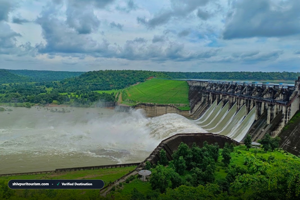
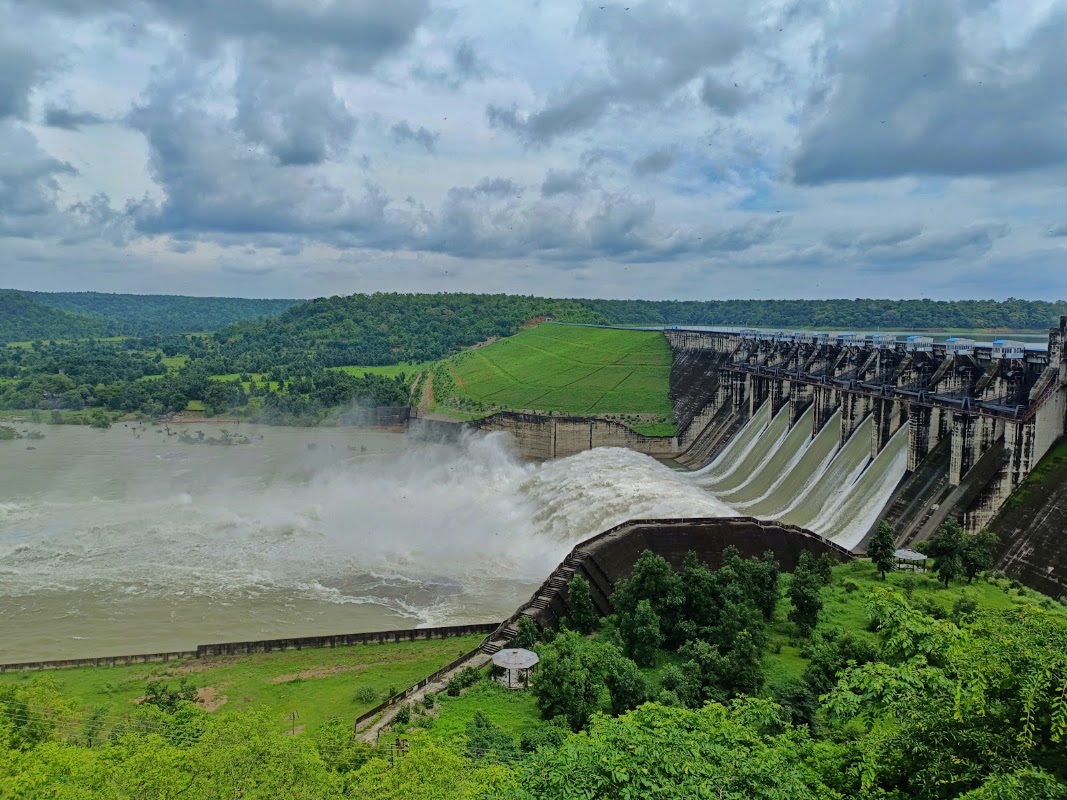
Madikheda (Atal Sagar) Dam & Mohini Pick-up Weir
Massive multipurpose gravity dam across the Sindh River — 62 meters high with 60MW hydel generation and breathtaking island-studded reservoir views.
Distance from your location
Allow location for approximate straight-line distance. Open Google Maps for the road route.
This page calculates on your device without saving location. Catalog pins remain under review.
🚨 Critical Visitor Safety & Legal Advisory:
Strictly prohibited from climbing on dam parapets, entering restricted powerhouse zones, or bathing in spillway currents.
🛣️ Distance & Exact Road Route Matrix
100% Road Distance| Starting Hub | Road Distance | Estimated Time | Transit Mode |
|---|---|---|---|
| District Collectorate (GPS Geodesic) | 40.2 km (Straight-line) | Map Benchmark | Road ~42 km |
| Shivpuri Bus Stand | 42 km | Depends on route and traffic | Auto, E-rickshaw, Taxi, Private Car |
| Shivpuri Railway Station (SVPI) | 44 km | Depends on route and traffic | Station Taxi & Auto Stand |
| Court Road Office (Bharti Infotech) | 42 km | Depends on route and traffic | City E-rickshaw / Walking / Bike |
🚗 Road Route Details: Road Distance: Approximately 30 km from Shivpuri Bus Stand via Satanwada-Narwar Road.
⚠️ Road Distance Disclaimer: Distances are catalog estimates, not independently verified routes. Road and straight-line distances differ. Confirm the visitor entrance and route before travel.
🚗 How to Reach (Air, Rail, Road & Local Transit)
✈️ Nearest Airport (By Air)
Gwalior Airport (GWL, 130 km).
🚆 Nearest Rail Hub (By Train)
Shivpuri Railway Station (SVPI, 32 km).
🛣️ Highway Road Access (By Road)
Paved state highway directly connects to the dam viewpoint and hydel station overlook.
🛺 Local Transit Guidance
Private cab or dedicated auto (minimum ₹300 to ₹500 round-trip) recommended from Shivpuri town.
🏨 Nearby Hotels & Recommended Stays
✓ Verified Contacts & TariffsMPT Tourist Village, Shivpuri
📍 Near Bhadaiya Kund, Circular Road, Shivpuri
💰 ₹2,800 – ₹4,800
Serene natural ambiance, multi-cuisine restaurant, lush gardens, near Bhadaiya Kund
Hotel Sonchiraiya (MPT Associate)
📍 Circular Road, Shivpuri
💰 ₹2,200 – ₹3,800
Family rooms, AC cottages, conference lawn, near National Park bypass
Hotel Siya Glitz / Landmark
📍 A.B. Road / Jhansi Road, Shivpuri
💰 ₹1,800 – ₹3,200
Modern amenities, restaurant, close to Shivpuri Bus Stand and SVPI Station
📜 A to Z Verified History & Architecture
Era: Modern Engineering Marvel (Commissioned 2008 by Madhya Pradesh WRD)Madikheda Dam (officially named Atal Sagar Dam) is a magnificent 62-meter-high concrete gravity dam constructed across the Sindh River. Commissioned in 2008 with an installed hydroelectric capacity of 60 MW (3x20 MW), it creates an expansive lake filled with submerged hill islands, often referred to as the 'Mini Sea of Central India'. Downstream at Mohini weir, water is channeled into extensive irrigation canals transforming regional agriculture.
🏛️ Architectural & Construction Style:
Modern engineering concrete gravity dam with 10 radial spillway crest gates and hydroelectric powerstation.
Key Historical Milestones:
- Stands 62 meters high and 1,070 meters long across the Sindh river.
- Generates 60 MW of renewable hydel electricity through three 20 MW turbines.
- Submergence area spans over 5,700 hectares, creating countless scenic hill islands.
🙏 Living Folklore, Beliefs & Cultural Traditions
✨ Primary Local Legend & Belief:
Local villagers remember the mighty flow of the ancient Sindh river and celebrate the dam as the lifegiver for millions of fertile farmland acres.
🌸 Cultural & Social Significance:
The prime lifeline of modern Shivpuri and Gwalior-Chambal irrigation and drinking water supply.
🎪 Annual Festivals & Traditional Fairs:
- National Engineers Day (September 15)
- Monsoon Dam Spillway Viewing Days
- Winter Lakeside Birding Trips
ℹ️ Visitor Practical Guide (Timings, Entry & Advisory)
🕒 Timings:
07:00 AM to 06:00 PM (Daylight hours)
🎟️ Entry Ticket:
Free viewing from designated public viewpoints; crest road subject to security checkpost permissions.
🌤️ Best Season to Visit:
August to February (Monsoon gate openings create thundering water cascades).
⚠️ Safety Advice:
Strictly prohibited from climbing on dam parapets, entering restricted powerhouse zones, or bathing in spillway currents.
❓ Frequently Asked Questions (FAQs)
On which river is Madikheda Dam constructed?
Madikheda Dam (Atal Sagar) is constructed across the Sindh River in Narwar tehsil, standing 62 meters high and generating 60 MW of hydroelectric power.